The Unfair Advantage
State-of-the-Art Equipment
We invest heavily in the latest geodetic technology to ensure your projects are completed faster, safer, and with uncompromising millimeter accuracy.
1 Private Island-Wide RTK Network
Unlike standard surveyors who rely on spotty public signals, we own and operate a proprietary, multi-station GNSS network across the region paired with 3 advanced rover units. This guarantees instant, reliable, millimeter-level GPS positioning for your site.
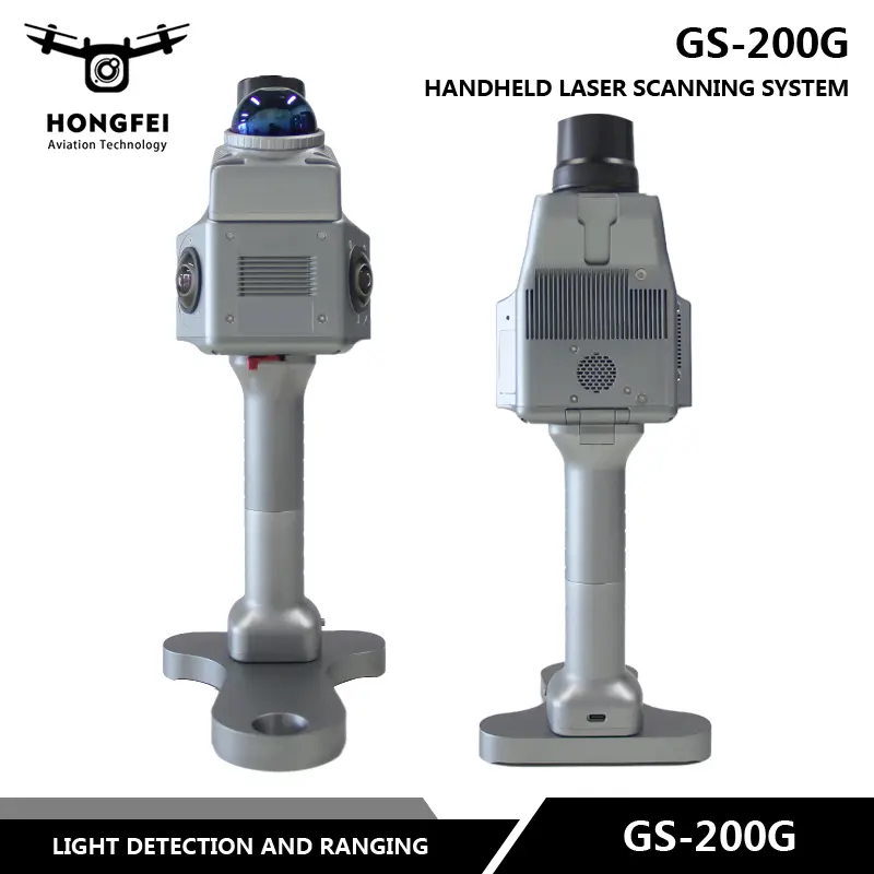
2 3D SLAM LiDAR Systems
Equipped with the advanced GeoSun GS-200, we provide high-efficiency spatial capture of complex buildings or indoor spaces. Our specialized post-processing then converts these raw point clouds into detailed, survey-grade assets for architects.
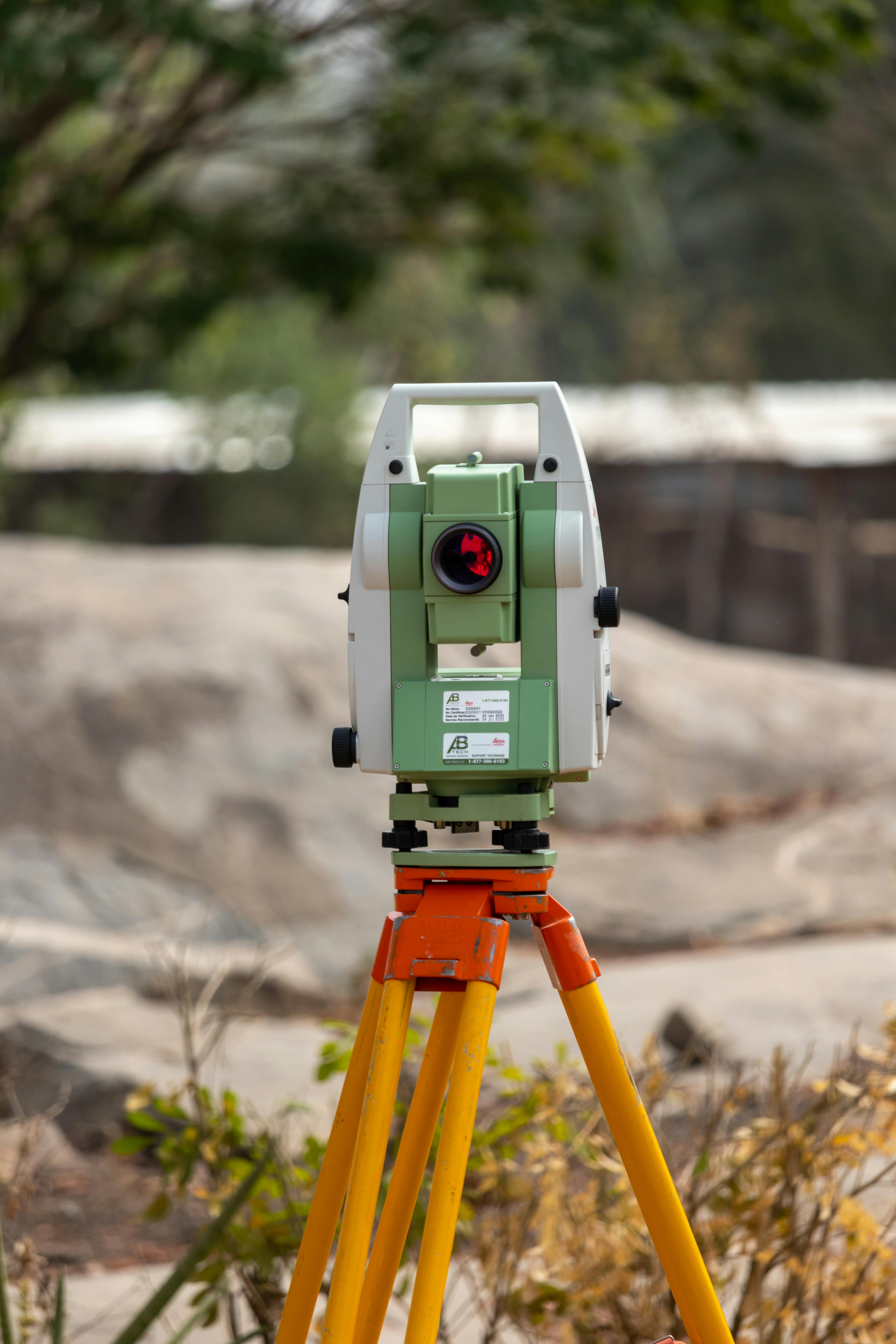
3 Robotic Total Stations
Using our dual Ruide RCS robotic instruments, we provide surgical precision for boundary line identification, construction stakeouts, and difficult-to-reach terrain where standard GPS fails.
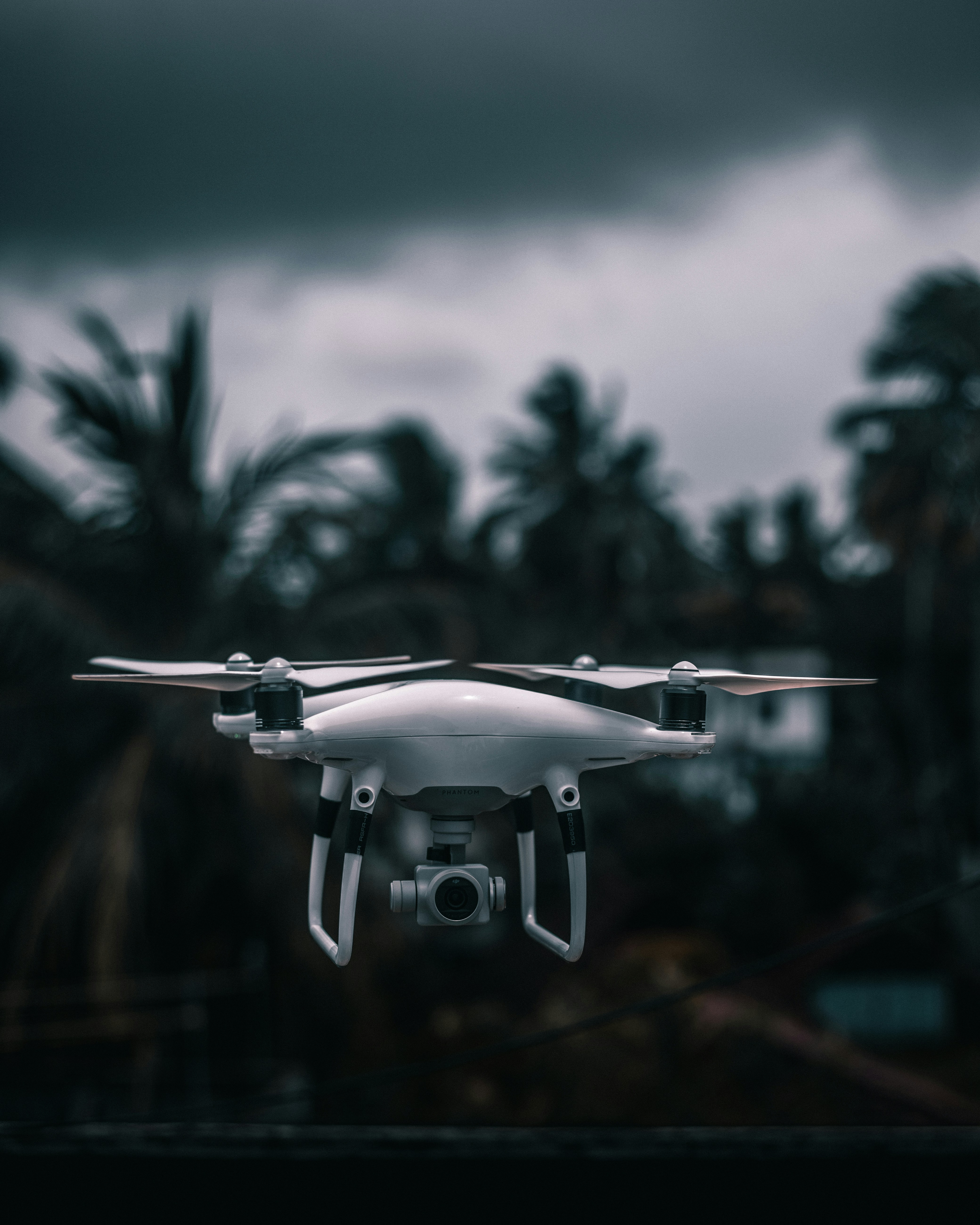
4 UAV Mapping Drones
Our dual DJI Phantom 4 Pro drones allow us to map massive land parcels from the air rapidly, safely, and with survey-grade accuracy using advanced photogrammetry.